
Approach: Bull-of-the-Woods to Wheeler Peak - Trail 90
8 miles one-way to the summit
elevation gain 3,961 feet
![]()
![]()
Photo 1: View of the summit from Williams Lake. Photo 2: Trailhead on Twinning Road ("Coyote" parking lot)
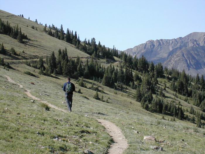

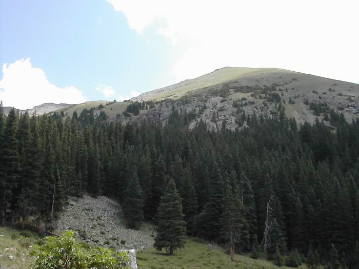
Photo 3: Trail from Bull of the Woods mountain. Photo 4: Looking from Mt. Walter to Mt. Wheeler


Photo 5: USGS on summit Photo 6: View back along ridge to Warner and other "false" summits.
We had planned to take the Williams Lake (Trail 62) approach, but spent over an hour trying to find the trailhead, before giving up. We had arrived at the Taos Ski Valley ski area at 6:00am and found that our maps, descriptions, Don Holmes, or nary a person at that early morning hour, could tell us where the trailhead was.
So regrouped, and began our hike from the ski area "Coyote" parking lot on Twining road at the Bull-of-the-Woods trailhead (Trail 90)---a decision we never regretted. Rather than having just the singular goal of "reaching the summit," via a steep trail (like the Williams Lake route; see photo 1), we were rewarded with a beautiful and memorable hike. My favorite highpoint hike thus far.
Our hike began at 7:10am with good weather. From the Bull-of-the-Woods trailhead (photo 2), the path veers left (northeastward) toward the Bull-of-the-Woods pasture, the trail doubles as a horse trail. The first section---a distance of about 2 1/4 miles---follows the forest boundary until you reach the Bull-of-the-Woods pasture. Most of the altitude gain is during this first part of the hike, and can be slow trudging if you aren't accustom to the elevation. [Note: though most descriptions indicate that the trailhead and trails are well marked, we found this not to be true. There are in fact too many choices, and perhaps because locals hike here so often, the trail is under-marked. Don't count on painted trees, kerns, or a plethora of signs.]
Once you reach the "pasture" (to me it was not really a pasture but a small clearing in the trees, and the entrance road to what I believe is a horse barn) the trail travels above timberline. The next/second section of the trail ascends from the pasture to Bull-of-the-Woods Mountain, and is a pleasant hike. The trail then climbs slowly, ascends the side of another mountain (photo 3), reaches a couple of smaller summits, and then lands you on Frazer Mountain (12,163 ft).
After you hike past Frazer Mountain the trail plummets into the La Cal Basin. This part of the trek can be disheartening because you loose a lot of elevation into a river basin/camp area only to have to hike back up the other side. However, the variety in the difficulty of this trail and the sections of the trail that allow you to catch your breath, are well worth the hike. From the basin the trail climbs back out of the woods, along the side of a ridge, and follows a series of switchbacks directly to your left and up to the ridge it self. The long switchbacks can be slow going. Once you reach the ridgetop you have gained 99% of the elevation on your trek and the rest of the hike is along a line of peaks leading to Wheeler.
At the end of the switchback (the top of the ridge) the trail leads you to the first false summit (a grassy mountain); walk around the grass-covered peak on the left, to another false summit (a rocky mountain); walk around that rocky mountain on the right, to the third false summit of Mt. Walter (photo 4). At this point you can see the also-rocky summit of Wheeler ahead on the ridge line and Horseshoe Lake below to your left. The hike from Walter to Wheeler is about 500 ft and time to enjoy the view---and the end of the false hope. An USGS marker, and a registration canister, is located on the summit. We arrived at 11:00am and could see for miles in every direction, we had no trouble with rain or thunderstorms.
Rather than take the same trail back we returned via the Williams Lake Trail (Trail 62). The decent was a rock slide all the way down the mountain to the lake, and a quicker way home. Williams Lake (view of summit, photo 1) is apparently a popular day hike destination from the ski resort. This trail is easy going and led us to the Phoenix Grill (which apparently is very accessible by rental car during the summer). If you want the shortest way to the summit, drive to the grill, hike to the lake, and then ascend the steep rocky mountainside to the summit. Everyone we saw that day had chosen this route. From the grill the trail followed the winter-ski-trail known as "Rubezahl" and ended just under Ski lift #1 and #5 at the resort center. We could not find any trailhead signs here to tell us that the road/trail is the Williams Lake Trail.